
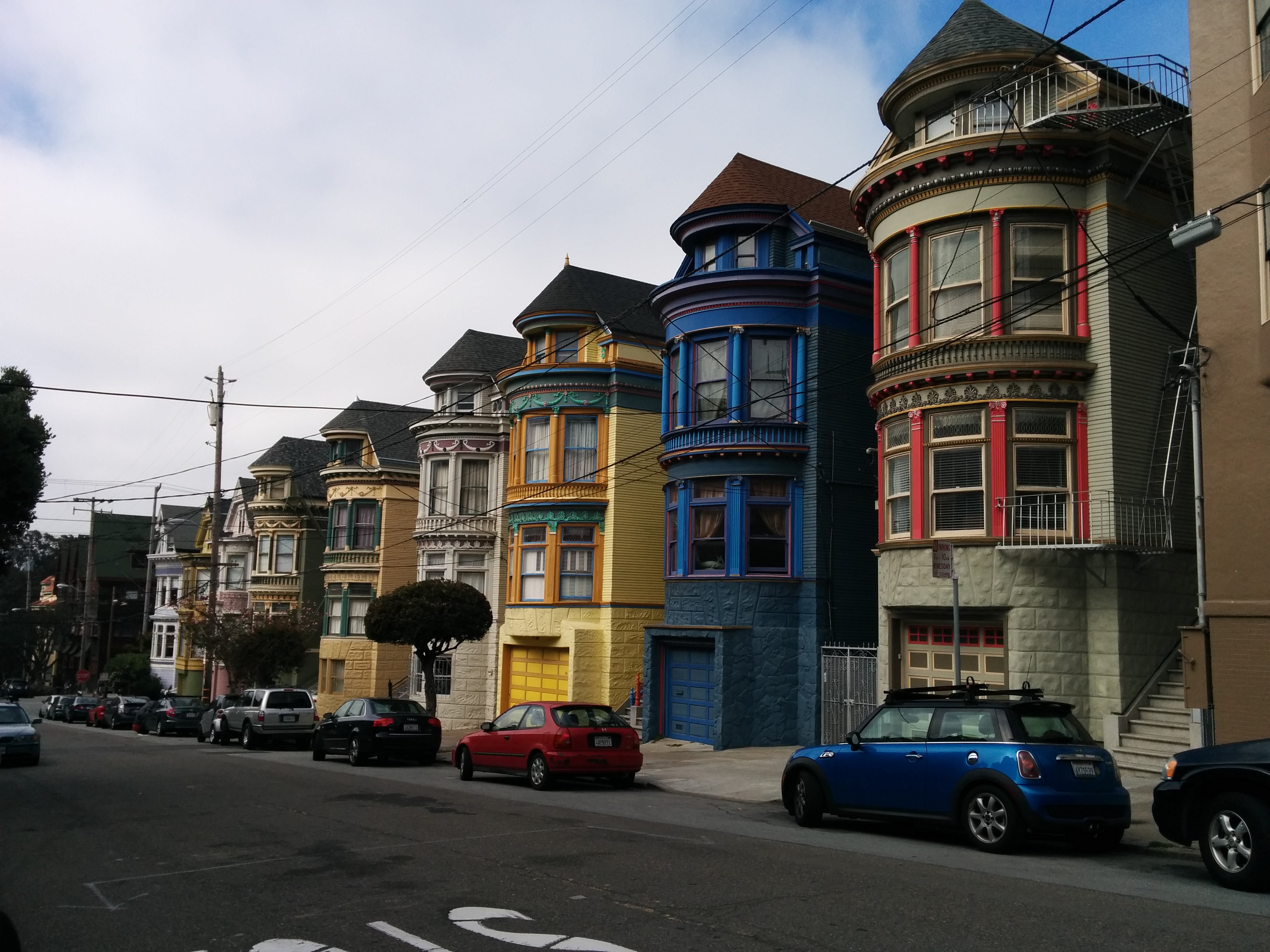
After a brief sojourn in Las Vegas, which both exhilarated and depressed me at the same time, we headed north to Utah and a date with a canoe on the Green River. The Green River flows from the Wind River Range in Wyoming and wends it’s way south to meet the Colorado River above the Grand Canyon. It’s been home to the Anasazi (think ruins high up in the cliffs), to Butch Cassidy and his gang (think bushrangers) and also the scene of a Burke-and-Wills-esque expedition by Powell, the first European to navigate the Green and Colorado rivers in 1869 (and who was such an atrocious leader that he was deserted by some of his team who could stand him no longer and quit the river to head north into Utah only to be killed by Mormons, Powell however made it). Although this canoe trip had long been on our hit list, we’d only got around to booking the trip ten days before. This is something of a novelty here, where trips (and campgrounds) are normally booked months and months in advance. I realise how lucky we are to be able to travel this way, stringing together mini-trip after mini-trip, any one of which for others would be the focus of their year. Blessed.

 Rivers in the US are proper, wide, fast-flowing rivers, not the intermittent creeks and streams more common at home. In fact, from what I’ve seen so far, at least in the west, almost every town is on a river. It’s easy to see how the density of towns and population are possible in this country – water supply everywhere. By the time it hits Canyonlands NP the Green River is flowing at 8000 cubic feet per second (faster than usual since it’s been a wet year in Utah). That equated to about 3 miles per hour. As we soon discovered, this had the unexpected but rather pleasant effect of meaning that we didn’t actually need to paddle at all in order to cover our 15 miles per day. In fact, there were other groups we passed on the river who were doing nothing but sitting in their boats and floating all day whilst they drank beer – could be the ultimate bogan camping trip!
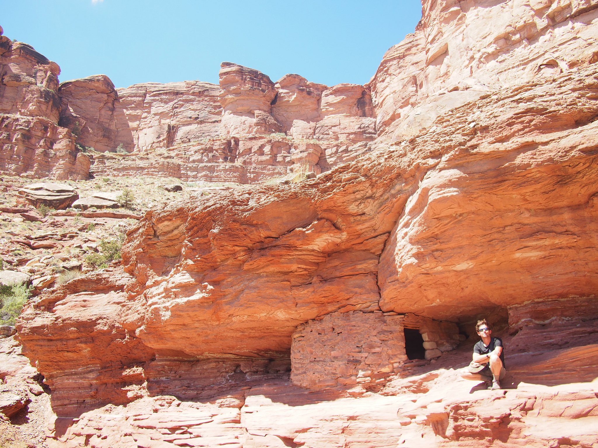
We did paddle (well, a bit) because we also wanted to hike up some of the side canyons. There were Anasazi houses and granaries to see, petroglyphs to discover, Butch Cassidy’s fort, an unexpected waterfall to cool us off; and amazing views to be had once we’d climbed out of the main canyon – although the river is actually two canyons deep, when we hiked up we were still looking up at more canyon walls.
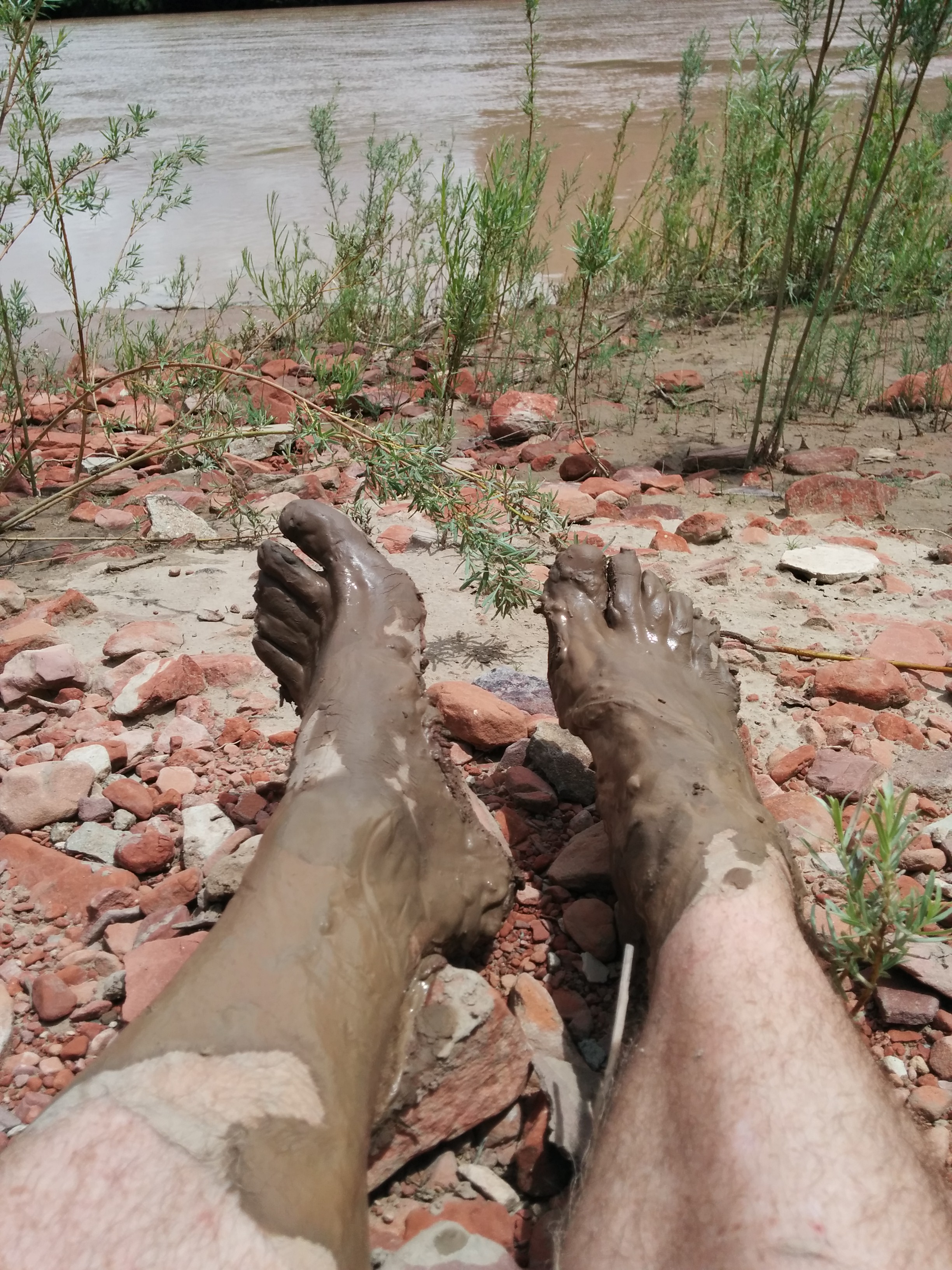 As some will know, I hate being dirty. Have since I was a child. (I know, I’m tarnishing my rugged outdoor image here). Since the reason canyons exist is because rocks and dirt are washed out of them, the Green River carries so much silt that it looks like coffee and your hands and feet disappear into it when you dip them in. And when we swam in it we came out less sweaty but covered in gritty sand. It was impossible not to get muddy feet (especially when Alan insisted on landing in side creeks that had quicksand-like properties and left us with mud to our calves) and I soon gave up trying.
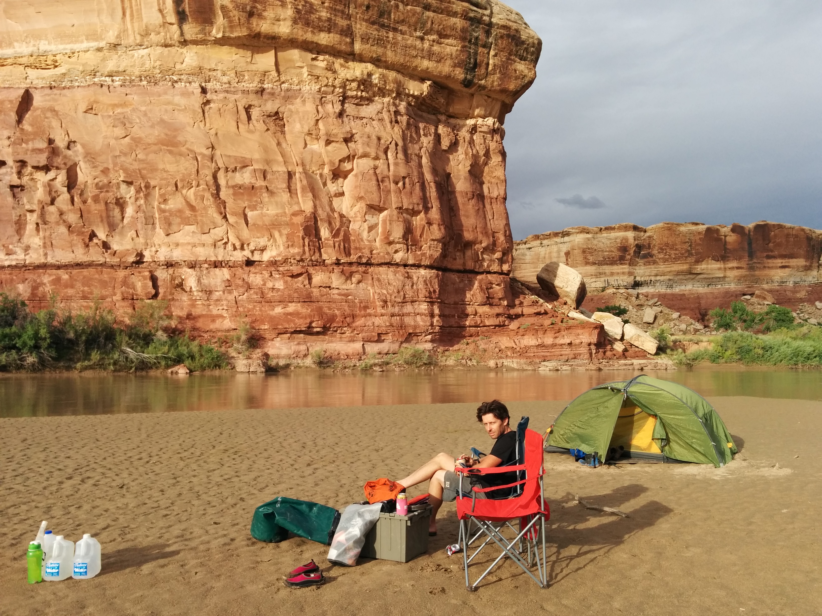
Camping when canoeing is a bit of a luxury when compared to hiking. Weight isn’t really an issue so as well as camp chairs we were also carrying an esky. Bliss to be able to have cold beer in such hot weather. Campsites were wherever we could find a place – sometimes on sand banks/islands rising from the river, sometimes on rock ledges up above it. There was much arguing about where to camp – Alan keen to be on the sand banks, which were often muddy, me keen to be up on the rocks and out of the dirt. Often the river moving so quickly that after a minute or two of discussion the question became moot as we were carried along and had to start looking for the next promising site.
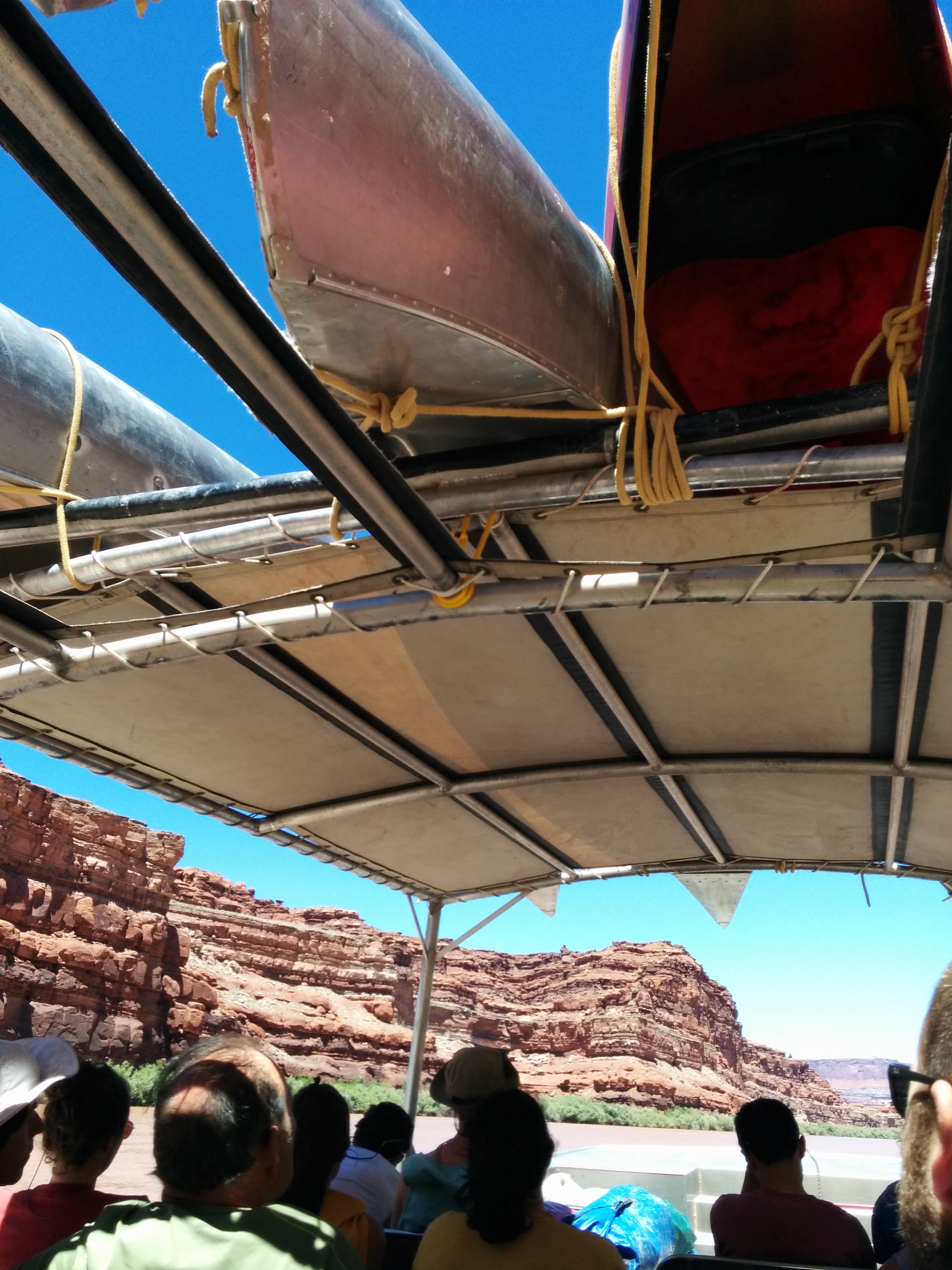
The Green River finally meets the Colorado River at a place called Spanish Bottom. Downstream from here the Colorado becomes a more serious whitewater river trip that although long on my wish list to do, does require booking long in advance, and would also necessitate a group trip, of which we are not fond. Whilst we’d been driven in to the start of the trip, there’s no road access to Spanish Bottom so we departed in style, collected by a jet boat, our canoes loaded above us, whisked upstream on the Colorado back to Moab.


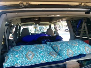
 Can sleep inside – very important for a number of reasons, not least of which is the ability to stealth camp when necessary/practical. She’ll come in handy when we sleep in a Walmart carpark (it’s a thing here and I have a hankering to try it) and in order to bush camp on Bureau of Land Management lands, as well as #vanlife ‘overnight parking’ which is allowed in some states. Also, many RV parks don’t have tent sites, and we’re finding that those that do can sell out fast. Astrid lets us camp on a concrete slab if we need to.


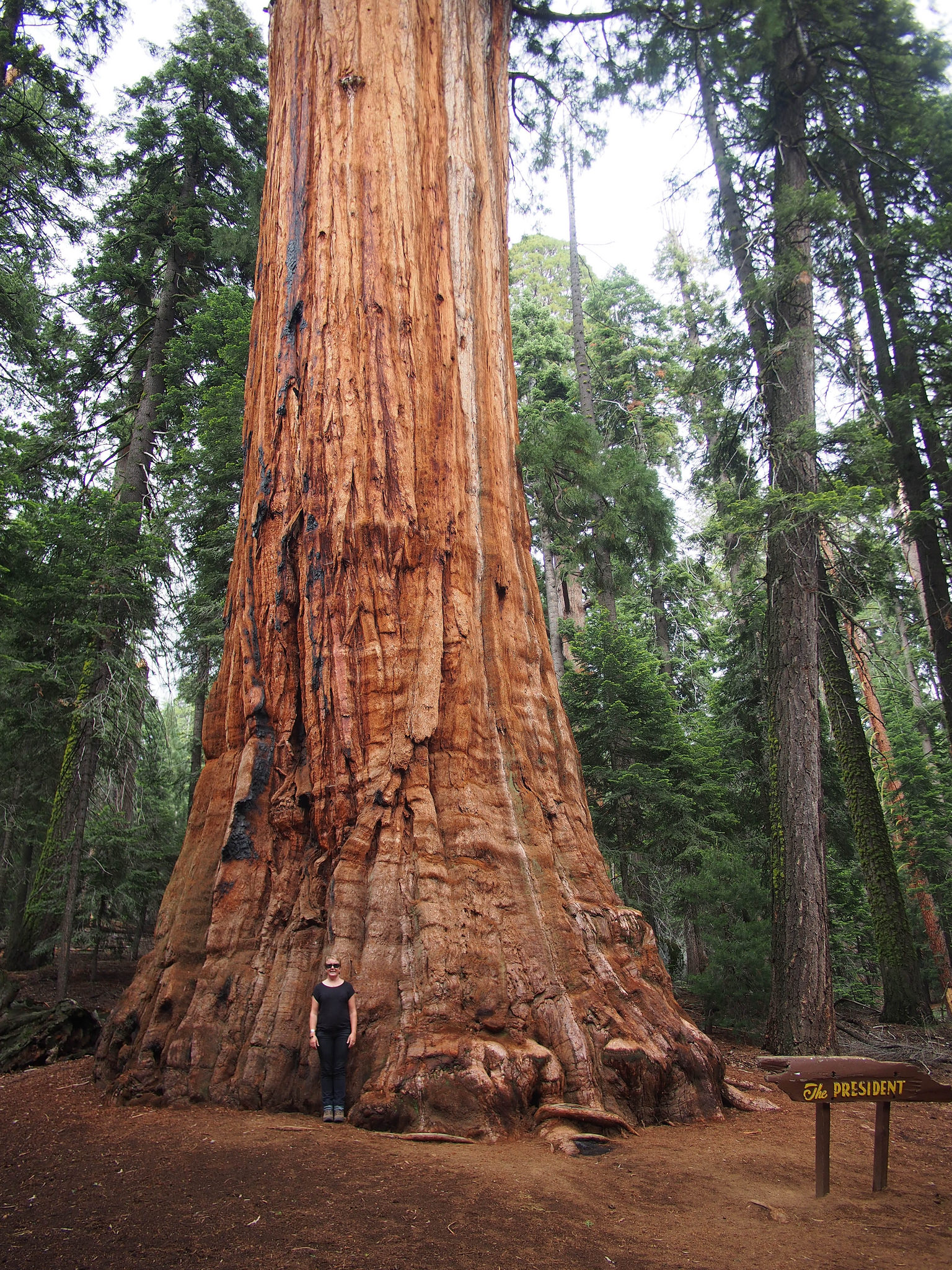
 Being summer, it was ridiculously busy. The campsite reservations book out months in advance, as do a lot of the backcountry walk permits and the gold Wonka tickets themselves – permits to climb Half Dome (only 300 of these are available per day and they go fast). But, there is a quota reserved for ‘walk ups’, on a first-come first-served basis. Get into camp before lunchtime and you should be able to score a site, queue for 2 hours the day before your hike and you might be able to score a backcountry permit. This caused us great angst on our trip in – would we or wouldn’t we have somewhere to sleep, were we prepared to queue despite our anathaema about queuing for anything, what was our back up plan? In spite, or perhaps because, of our worrying we easily got a campsite – we’re not quite in peak season yet. And, when we went to the Wilderness Office about 4pm we discovered that there were still permits available for our chosen hike starting the next day (no queuing necessary), and, something I hadn’t even entertained, we could add on a permit to climb half dome. Plus we were entitled to cheap camping the night before and after our hike. Score!
 e walked for three sublime days (OK, two and a half as we spent the afternoon of the first day lazing around a perfect alpine lake and being eaten by mosquitos) from Tuolomne Meadows, at a height of 8000 feet, up over Clouds Rest and Half Dome at nearly 10,000 feet, down to the valley floor at 4000 feet. Yes, I am glad we walked down rather than up, but that descending was hell on the thigh muscles! We were struck by the lack of snow. At this time of year there should still be quite a lot about, but California is into it’s fourth year of drought (the news here is filled with reports of water-saving initiatives – oh so familiar) and the snowpack is scanty – the iconic Bridal Veil Falls was reduced to a slight mist of water that had almost blown away before it reached the end of it’s long drop and a stream without water meant we had to make a three hour backtrack for water – the longest water run either of us have undertaken.
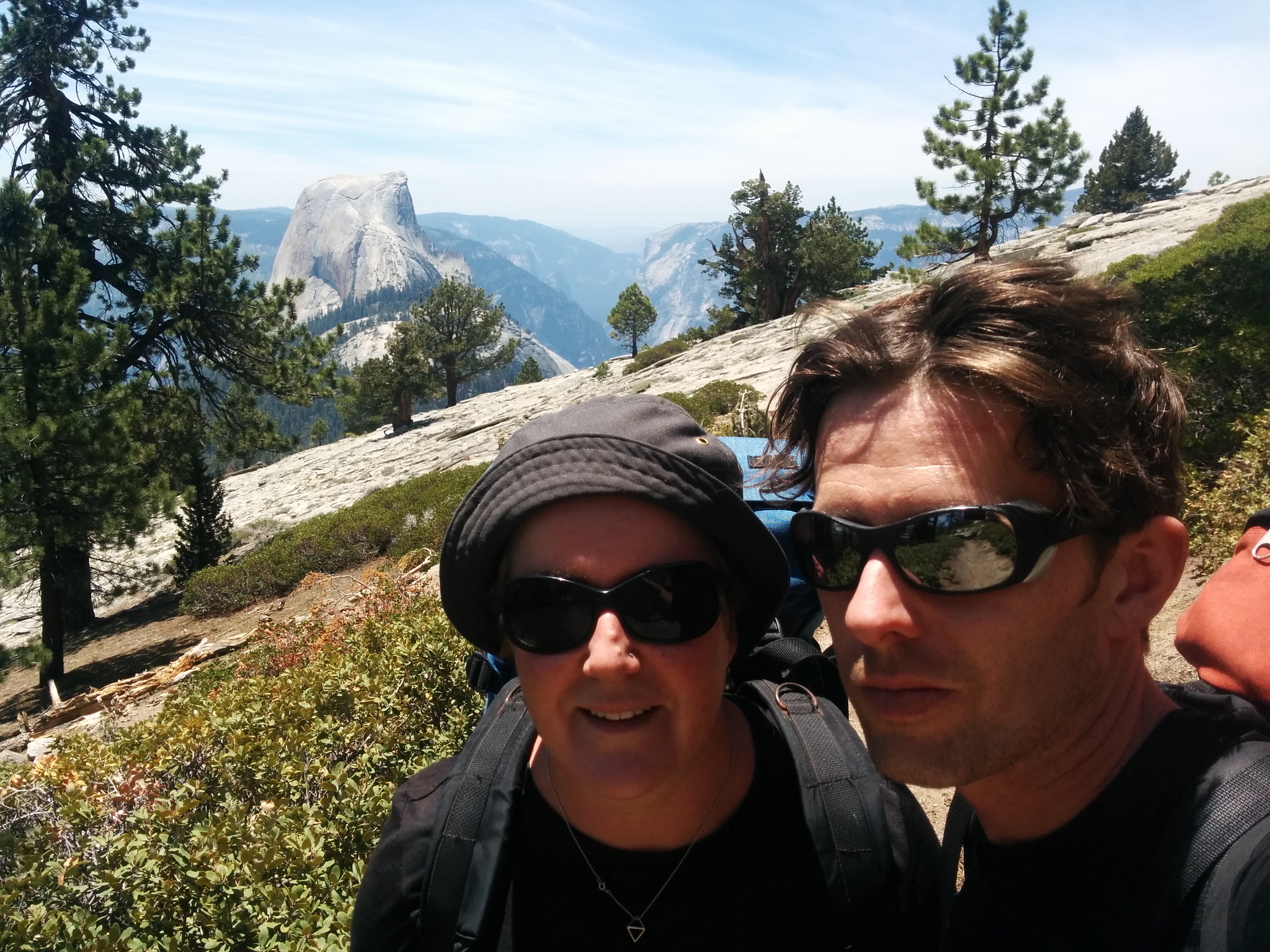
 The water run was needed so that we could camp high up on the north east shoulder of half dome in order that we might get onto the cables to the summit before the crowds of day hikers arrived and the climb becomes something of a slow upwards shuffle. Our ploy worked and after a glorious night camped on our own (!) overlooking an amazing granite-filled valley 4000 feet below us we were climbing by 8am. The climb to the summit is quite something. 45 degrees most of the way up, the granite is slick from so many feet and despite best intentions we found ourselves hauling our weight up the cables using our arms (climbing tip 101: legs have more power and tire less easily). Exhausting, especially in the thin mountain air. The trip down, by contrast, was dead easy. In Europe this would be a ‘via ferrata’ route that requires wearing a safety harness and clipping to a cable for safety, but here there is only my strength and balance preventing a long slide down the mountain. And yet there are many less fit than I on this route. In fact, they are also almost all younger than I, and almost all dressed in the same outfit of brightly coloured, running clothes. It’s kinda like being in a gym.
 In other news, we saw a bear!


